Skip directly to search Skip directly to A to Z list Skip directly to page options Skip directly to site content

Socioenvironmental Maps—Poverty
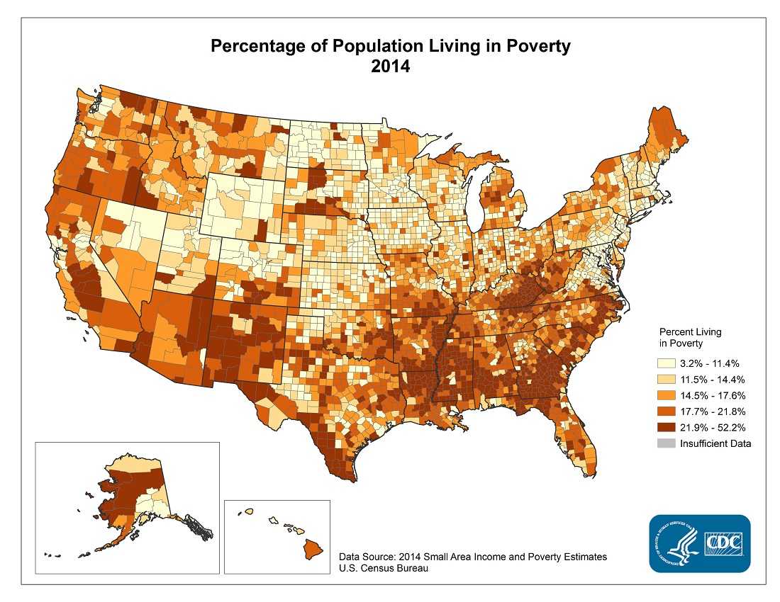
Percentage of population living in poverty, 2014. Counties with the highest percentage of the population living in poverty in 2014 were located primarily in Mississippi, southern Georgia, eastern Kentucky, and parts of Alaska, New Mexico, southern Texas, and Alabama. The range in the percentage living in poverty was between 3.2% and 52.2%.


To view this map in a larger format, click HERE [PDF–2.9M]

To view the data table for this map, click HERE [Excel-114K]

Top